
SeLECT
Self-Learning Atlas of Ancient European CulTures
LAT – SVE – ENG – ITA
Chartographia: selecteplus.eu — QGISCloud

Institutum conatus est novum instrumentum historiae et geographiae antiquae demonstrandi, atlantem facile utendum de linguis et culturis europae, antequam romanorum imperium instauratum est. Cum progressu et diffusione mundi graecoromanis, linguae culturaeque istae minores evaserunt quarum huiusmodi haereditas saepe neglegitur in scholis. Atlantis nostri intentio est europaeis imaginem geographicam omnimodam exhibere antiquissimarum europae culturarum per instrumentum visuale ut historia nova atque innovativa discatur. Tabulae, quas discipuli et investigatores interactivas creare poterunt, ad territorium pertinent, quod et hodie et in praeterito semper crescit et fines suos mutat.
Institutum hoc fundatur in hominibus, qui in europae praeterito vixerunt et qui testes scripti reliquerunt, quorum memoria ut res historia restituatur maxime conducat. Atlas linguas litterasque exhibit, quae non romanae neque graecae sunt, et quae inter saeculum octavum a.C. et saeculum tertium p.C. conscripta sunt. Atlas spectat in regionem, quae partes europae occidentalis, centralis et orientalis complectitur, quae varie temporibus romani imperii subiacuerunt.
Projektet syftar till att tillhandahålla ett nytt verktyg för studier av forntida historia och geografi genom en tvärvetenskaplig, interaktiv och användarvänlig atlas över de språk och kulturer som existerade i Europa före romaniseringen. Med utvecklingen och utvidgningen av den grekisk-romerska världen har dessa språk och kulturer blivit minoriteter, “minoriteter från det förflutna”, vars arv ofta försummas i skolorna. Vår ATLAS syftar till att ge européerna en heltäckande geografisk bild av de äldsta europeiska kulturerna genom ett visuellt verktyg för att lära sig det historia på ett innovativt sätt. De kartor som elever och forskare kommer att kunna skapa interaktivt hänvisar till ett territorium som, både i nutid och i det förflutna, kontinuerligt utvecklas och ändrar sina gränser.
Projektet utgår från att de människor som levde i det forntida Europa och som har lämnat skriftliga vittnesmål är de mest relevanta för att rekonstruera det historiska scenariot. Atlasen fokuserar på icke-romerska och icke-grekiska skriftliga dokument som dateras mellan 800-talet f.Kr. och 300-talet e.Kr. och som sträcker sig i ett område som spänner över västra, centrala och östra Europa som under olika perioder omfattades av det romerska imperiet.
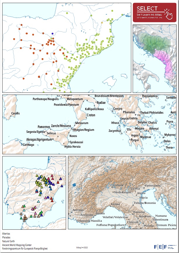
The SELECT project aims at enhancing the study of ancient history and geography by means of a multidisciplinary, multilayered, interactive and user-friendly self-learning atlas of the cultures of ancient Europe before Romanisation. The ancient peoples outside the Greek-Roman world are the “minorities of the past”, whose heritage is often neglected in the school. The ATLAS will provide the European citizens with an overall view of the most ancient European linguistic and cultural heritage, which will be objectified on maps, powerful visual tools in learning the past.
The project assumes, as most relevant to reconstruct the historical scenario, those peoples settled in ancient Europe which have left a written presence. A chronological range from oldest written documents in the 8th c. BC up to Romanisation era (3rd c. AD) is set. The geographic area covers the areas of Western, Central and Eastern Europe that correspond to the larger extent of the Europan part of the Roman Empire.
Il progetto SELECT mira a migliorare lo studio della storia antica e della geografia attraverso un atlante multidisciplinare, multistrato, interattivo e di facile apprendimento delle culture dell’Europa antica prima della romanizzazione. L’ATLAS presenta agli utenti una visione d’insieme del più antico patrimonio linguistico e culturale europeo, rappresentato attraverso la cartografia, un potente strumento visivo per l’apprendimento e per la ricerca. L’arco cronologico del progetto va dai documenti scritti più antichi dell’VIII secolo a.C. fino all’epoca della romanizzazione (III secolo d.C.). L’area geografica copre le zone dell’Europa occidentale, centrale e orientale che corrispondono all’estensione della parte europea dell’Impero romano.
